Field-ready coordinate calculator for parallel-line surveying
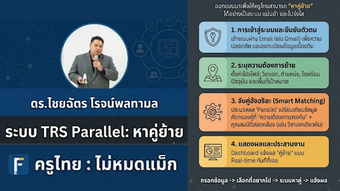
TRS parallel from KRUTHAI-MAIMODMAX is an Android utility for surveying and civil engineering tasks, designed to compute parallel-line coordinates on-site. The app performs coordinate-geometry calculations for points offset from a baseline, including station or chainage positions, and supports left and right offsets. Suited to land surveyors, construction managers and geomatics students, it provides practical COGO practice during field labs and site layout exercises. The developer targets niche engineering tools for the Thai technical community.
Top Recommended Alternative

What the tool does for field layout and surveying
TRS parallel is a specialized technical utility that calculates coordinates for points on a line parallel to a defined baseline, addressing a common surveying need. The app accepts start and end Northing/Easting values and computes offset locations so users can derive on-site stakeout coordinates without manual trigonometric work. That function matches tasks found in road design, construction layout, and land boundary staking.
How it supports hands-on learning for geomatics students
The app supports applied learning by letting students practice coordinate geometry problems in a practical setting. Inputting baseline coordinates and offset distances converts classroom exercises into field assignments, reinforcing measurement-to-calculation workflows. Because the developer designed the tool for mobile field use, learners can replicate professional tasks during lab sessions and compare calculated outputs with measured points for skills validation.
Is it suitable for work in remote or offline sites?
Yes; TRS parallel performs calculations locally on the device, which makes it appropriate for remote fieldwork where connectivity is absent. The Android-only distribution means deployment relies on Android devices and availability via the Google Play Store, so instructors should confirm device compatibility before assigning it for field exercises or student use in lab rotations.
How results are presented for verification and classroom use
The app produces clear digital coordinate outputs intended for immediate field use, which instructors can incorporate into assessment workflows. It supports:
- Left and right offset specification for parallel-line tasks
- Station/chainage point calculations along the parallel
- Start/end coordinate input fields for baseline definition
These outputs make it straightforward to record results for lab reports or site notes.
Practical field tool for training; pair it with classroom assessment
TRS parallel is a focused option for surveying students and early-career engineers who need hands-on practice with real-world coordinate tasks. Its narrow, applied scope means instructors should design complementary assessment and record-keeping workflows so field exercises translate into graded outcomes. Tip: require students to submit calculation snapshots or structured lab reports to capture learning progress during site sessions.